
Purpose
Section 7 of the Flood Control Act of 1944 authorized the federal government to prescribe rules and regulations for dams in the interest of flood control. These rules state that the project (dam) owner is responsible for real-time implementation of a water control plan, and the United States Army Corps of Engineers (USACE) has authority to determine flood releases in the flood control space with input from the owner. There are many such reservoirs in California’s Central Valley.
One of the focus areas of my team at MBK Engineers is reservoir operations for flood events. This means it’s our job to understand how operators are required to manage their reservoirs to mitigate downstream flood damages by applying the rules prescribed and regulated by USACE. In our work, we have developed an understanding of the operating rules by which many of the reservoirs in the Central Valley function when in flood control mode.
This is a summary of the characteristics of those reservoirs. Of particular interest was the spatial variation in those characteristics throughout the Central Valley, so that is what has been highlighted herein. Hopefully, this presentation is useful and facilitates the development of an enhanced understanding of the flood control regulations of these reservoirs and their geographically distinctive characteristics.
The data
Several years ago, I created a spreadsheet to summarize the characteristics of reservoirs in the Central Valley of California with flood control reservations. There are 17 of these in total, and they range from Shasta Dam in the northern portion of the Sacramento River basin to Isabella Dam on the Lower Kern River in the Tulare Lake basin. Here is a portion of the data I compiled.
| Reservoir | ID | Capacity (TAF1) | Max. flood reserve (TAF1) | Max. objective release (cfs2) | Operator | Constructed |
|---|---|---|---|---|---|---|
| Shasta | SHA | 4,552 | 1,300 | 79,000 | USBR | 1945 |
| Oroville | ORO | 3,438 | 750 | 150,000 | DWR | 1968 |
| New Bullards Bar | NBB | 966 | 170 | 50,000 | YCWA | 1970 |
| Folsom | FOL | 966 | 600 | 115,000 | USBR | 1956 |
| Black Butte | BLB | 136 | 136 | 15,000 | USACE | 1963 |
| New Melones | NMS | 2,420 | 450 | 8,000 | USBR | 1979 |
| New Don Pedro | DNP | 2,030 | 340 | 9,000 | MID/TID | 1971 |
| New Exchequer | EXC | 1,024 | 350 | 6,000 | Merced ID | 1967 |
| Hidden | HID | 90 | 65 | 5,000 | USACE | 1975 |
| Buchanan | BIC | 150 | 45 | 7,000 | USACE | 1975 |
| Millerton | MIL | 520 | 170 | 8,000 | USBR | 1947 |
| Camanche | CMN | 417 | 200 | 5,000 | EBMUD | 1963 |
| New Hogan | NHG | 317 | 155 | 12,500 | USACE | 1963 |
| Pine Flat | PNF | 1,000 | 475 | 4,750 | USACE | 1954 |
| Terminus | TRM | 186 | 174 | 5,500 | USACE | 1962 |
| Success | SCC | 82 | 75 | USACE | 1961 | |
| Isabella | ISB | 568 | 400 | USACE | 1953 |
1 TAF = thousand acre-feet
2 cfs = cubic feet per second
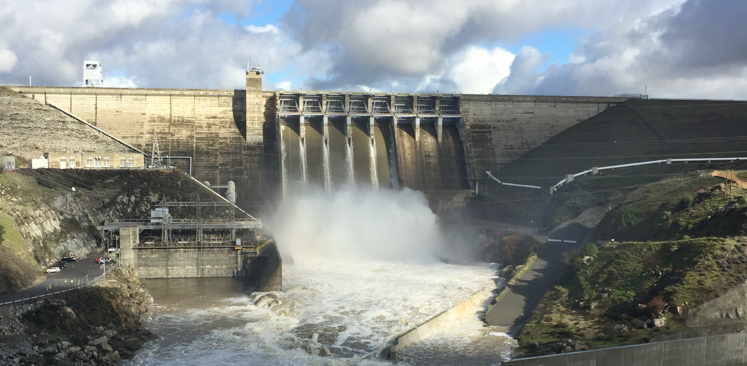
Flood reservoir operations basics
In its most fundamental form, a reservoir operation of a flood event is a battle against inflow. The reservoir operator has two weapons in that battle:
- storage
- release
Every reservoir has a limited capacity for each. The larger the storage capacity and maximum permissible release rate, the greater the capacity for a reservoir to manage a flood event.
As might be expected, the actual operations of these facilities involve a bit more nuance. For example, operators must also limit rates of release change, since they can’t be too extreme to endanger the public or cause stability problems in a downstream channel or levee system. The releases might also be based on a forecast, so operators must consider those and their inherent uncertainty. There are also emergency operations, including the potential usage of emergency spillways. Those operations have their own specialized diagrams and rules to consider.
The maps
The following maps show characteristics for Central Valley flood control reservoirs. These characteristics were each selected to highlight the similarities and differences between the reservoirs in relation to the flood protection each provides. These maps all have three basins outlined. From north to south, these are:
- Sacramento River
- San Joaquin River
- Tulare Lake
Basic parameters
Even plotting just the basic flood control characteristics of each reservoir provides some insight in flood operations in the Central Valley.
Total storage capacity
This map shows the total storage capacity of each reservoir. The size of each reservoir’s marker is proportional to its total storage capacity in TAF.
As is illustrated, the largest reservoirs in the State are in the Sacramento River basin to the north, e.g., Shasta (Sacramento River) and Oroville (Feather River). The reservoirs are generally smaller in capacity as we move south, although there are a few large reservoirs in the San Joaquin system. For example, New Melones (Stanislaus River) and New Don Pedro (Tuolumne River) are each more than 2 million acre-feet in total storage capacity.
Rainflood reservation
Here we have the maximum wintertime rainflood reservation, in TAF, for each reservoir shown on a map.
The general trend is that the largest wintertime rainflood reserves are within the largest reservoirs in the north (Sacramento basin). The San Joaquin has some reservoirs (New Melones, New Don Pedro, and New Exchequer) with fairly large rainflood reservations, however.
Maximum objective release
This map shows the maximum objective release from each reservoir per its water control manual. The size of the marker for each reservoir on the map is proportional to that reservoir’s maximum objective release.
The maximum objective releases from these reservoirs show a clear trend as we move from north to south. In the north, where the rainflood threat is greater and the channel capacities are larger, the maximum objective releases are also significantly larger than their counterparts to the south. The largest maximum objective releases in the Sacramento basin are 10 to 20 times larger than any of those for the San Joaquin basin. For example, Oroville Dam has a maximum objective release of 150,000 cfs, where no reservoir on the San Joaquin tributaries has a maximum objective release in excess of 10,000 cfs.
This presents a challenge for the San Joaquin tributary reservoirs under the threat of climate change, since that has been predicted to mean more precipitation falling as rain during storms than historically has occurred in those basins. That will mean an increased rainflood threat and a reduced level of rainflood protection provided by the reservoirs, absent effective mitigation measures.
Conditional space
Conditional space is used herein to refer to any flood control reservation which depends on conditions in the watershed of the reservoir. Conditional space reservations for rainflood and snowmelt-induced runoff are formally maintained in Central Valley reservoirs.
Rainflood
Conditional rainflood reservations are maintained at many Central Valley reservoirs. At those reservoirs, the conditional rainflood reservations have taken one of the following forms:
- forecast-informed: size of rainflood reservation required is a function of the reservoir inflow forecast over the next X days;
- precipitation-based parameter: size of rainflood reservation required is a function of the precipitation in the reservoir’s watershed over the past Y days; computed as a parameter used on the flood control diagram;
- inflow-based parameter: amount of rainflood reservation required is a function of the reservoir inflow over the past Z days; computed as a parameter used on the flood control diagram.
Additionally, some reservoirs (Camanche, Millerton, Pine Flat) are allowed to exchange portions of their flood reservations for vacant storage space in reservoirs located upstream of them within the same watershed.
Snowmelt
The majority of the watersheds draining to these reservoirs receive regular wintertime snowfall. That means that those reservoirs also receive snowmelt-induced runoff in the springtime. For some basins, that wintertime snowfall can be so plentiful and its subsequent springtime runoff predicted to be so severe that dedicated storage reservation in the reservoir is required to capture it in those years. The creation of this conditional snowmelt reservation reduces potential downstream snowmelt-driven flooding impacts in those years.
Derived measures
As previously expressed, there are only two fundamental ways a flood control reservoir can be leveraged to manage a flood event: storage or release. To see the balance between storage and release for each reservoir, two metrics were developed and plotted spatially.
Time to empty rainflood reservation
The amount of time required for a reservoir to fully empty its rainflood reservation with a maximum objective release is an indicator of the balance between the reservoir’s storage and release capabilities. Short durations indicate significant release capacity in relation to storage capacity. However, higher ratios indicate storage-dominant rainflood management for a reservoir. This metric was calculated by taking the maximum wintertime rainflood reservation and dividing it by the maximum objective release rate (converted to TAF).
As this map highlights, despite having larger maximum rainflood reservations, the Sacramento basin reservoirs have significantly shorter emptying times than their counterparts to the south. This is because these Sacramento basin reservoirs also have significantly larger maximum objective release rates than the San Joaquin and Tulare Lake basin reservoirs’ more modest release rates. Therefore, the San Joaquin and Tulare Lake basin reservoirs are more storage-dominant rainflood operations.
For an example of this storage dominance, consider the operation of New Don Pedro’s reservoir in early 2017. As shown here, New Don Pedro started filling in January 2017 as heavy rains began. Throughout January in into mid-February, those rains continued, and despite releasing as much as possible and following its flood control regulations, the reservoir spilled on February 17, 2017. The reservoir simply wasn’t able to manage such an unusually large and long lasting series of rainfall events.
To the contrary, with the exception of Oroville Dam’s unique spillway failure in February 2017, the Sacramento basin flood control reservoirs were able to manage the same two month series of extreme precipitation without spilling. This is because those reservoirs had the advantage of much larger downstream channel capacities to utilize throughout that wet winter.
Portion of the maximum rainflood reservation that can be released in 3 days
A similar characteristic is the portion of a reservoir’s flood control reservation that can be released in 3 days. A metric was developed for this purpose by taking the maximum objective release, multiplying it by the 3 days specified, then dividing that result by the maximum wintertime rainflood reservation. 3 days was chosen, because it is the approximate length of many major rainflood events in the Central Valley.
This metric is admittedly simplistic. It doesn’t account for downstream tributary flow that would reduce the reservoir’s ability to actually output the full objective release for 3 days, and it assumes the maximum objective release can physically be made for the entire 3 days. Nevertheless, this is still considered a telling measure and appropriate way to demonstrate the reservoir’s ability to release water relative to the size of its rainflood reservation.
Conclusions
This presentation has hopefully been informative and perhaps even insightful. I have worked in flood operations with these reservoirs my entire career. This has included studying their water control manuals, developing models and simulating their operation for flood events, and communicating this knowledge to others. Despite that, it wasn’t until just recently that it occurred to me to present this data with maps. And seeing the data in this format revealed new things to me, as well.
Reservoir operation is one of the few ways we actively manage our water resources and thus can make significant and unique positive impacts when facing future challenges, such as mitigating adverse climate change induced impacts on hydrology. By sharing some of what I know on this topic, I hope to capture the interest of others in such pursuits.